By date
By place
- Agra
- Arugam Bay
- Australia
- Bali
- Bangkok
- Battambang
- Beijing
- Buryatia
- Cambodia
- Chiang Mai
- China
- Chongqing
- Delhi
- Galle
- Goyambokka
- Guilin
- Halong Bay
- Hanoi
- Ho Chi Minh City
- Hoi An
- Hue
- India
- Indonesia
- Irkutsk
- Java
- Kandy
- Koh Samui
- Koh Tao
- Lake Baikal
- Laos
- Listvianka
- London
- Luang Prabang
- Malaysia
- Mekong Delta
- Mirissa
- Mongolia
- Moscow
- Mumbai
- Nanning
- New Zealand
- Nomad ger camp
- North Island
- Northern Territory
- Nuwara Eliya
- Penang
- Phnom Penh
- Polonnaruwa
- Rajasthan
- Russia
- Saigon
- Sapa
- Siberia
- Siberian village
- Siem Reap
- Singapore
- South Island
- Sri Lanka
- St Petersburg
- Tangalle
- Tasmania
- Thailand
- Tissamaharama
- Tourist Ger Camp
- Trans-Siberian Railway
- Ulaan Bataar
- Ulan Bataar
- Ulan Ude
- Unatwatuna
- Uncategorized
- Vietnam
- Western Australia
- Wuhan
- Xi'an
- Yangshou
- Yangtse cruise
- Yekaterinburg
Tag Archives: North Island
New Zealand, North Island day 14 – Rotorua
We wake to the most glorious view from our little tent – the sun rising over the lake just feet from our pitch, the waters lapping gently and the ducks waddling just outside the tent. Can it get better than this? A rowing team is out for an early morning training session and someone is paddling a kayak.
We have to be up and out early for our trip to Wai-o-Tapu Thermal Park. This park covers some 18 sq km and is the largest area of surface thermal activity in the Taupo volcanic region. The area is covered with collapsed craters up to 50 metres in diameter and up to 20 metres deep. Most have been formed over the last few hundred years by the action of acidic vapours rising from the below ground and dissolving the ground above. There are boiling pools of mud, water and steaming fumeroles. We arrive early for the eruption of the Lady Knox geyser which is primed to blow at 10.15am every day. The geyser is a short drive from the Visitors Centre and we overhear an American complaining – in all seriousness – that they should have built the geyser nearer the Visitors Centre! The geyser is induced to blow by using chemical blocks to break the tension of the surface cold water allowing the hot water beneath to shoot up several metres into the air. An impressive sight. The geyser was discovered by convicts whilst washing their clothes in the hot surface pool; soap breaking the surface tension and causing it to blow! There are 25 points of specific interest in the park and we spend about an hour-and-half fascinated by the effects of the thermal activity. Beneath the ground is a system of streams which are heated by magma left over from earlier eruptions. The water is so hot (temperatures of up to 300 degrees C have been recorded) that it absorbs minerals out of the rocks through which it passes and transports them to the surface as steam where they are absorbed into the ground. As a result there is a wide range of coloured deposits in the area adding to the dramatic effect – green, orange, purple, white, yellow, red-brown and black The most spectacular are the vivid lime green Devil’s bath, the pale green of Lake Ngakoro, and the multi-coloured Artist’s palette. There is a board walk across a huge sinter terrace which cover an area of 3 acres and has been created over the last 700 years as silica has been deposited from the water that trickles over it. www.waiotapu.co.nz
After lunch we visit the Te Puia Maori cultural centre. This is set in another geo-thermal park. Although not as varied as Wai-o-Taipu, the large and vigourously boiling mud pool, Nga Mokai a Koko, and the 30-metre Pohutu geyser which spontaneously erupts 20 times a day soaking bystanders with a fine, cold water spray, are dramatic. There are several traditional Maori buildings here, including Te Aroni a Rua Meeting House – decorated with intricate carvings, woven wall panels and patterned roof beams – as well as nationally re-knowned carving and weaving schools which teach traditional Maori skills. The highlight though is the cultural performance of action song and dance which starts with an elaborate Maori welcome haka led by a Maori warrior on the marae (the area in front of the meeting house). After the formal welcome ceremony we enter the meeting house for a performance of wonderfully uplifting, evocative and graceful action songs and very dexterous poi and stick dances. (Poi are balls on cord which are twirled whilst rhythmically hitting the back and front of the hands) and a powerful haka full of energetic movements and fearsome facial expressions including bulging eyes and the sticking out of tongues. The Polynesian roots of the Maori culture are very much in evidence in the traditional dress, the rhythms and the hand and body movements..
New Zealand North Island day 13 – Rotorua
We are continuing our drive south with the intention of reaching Wellington on Sunday. Our next stop is Rotorua in the heart of New Zealand’s volcanic area and famed for it’s geo-thermal activity – hot springs, boiling mud pools and geysers. There are also a number of Maori heritage ‘villages’ offering an insight into Maori arts, crafts and culture. There is a whole host of other activities in the area to draw tourists – sky-diving, karting, helicopter rides, spas, wild life park. Basically, you name it and it’s probably within 30 kms. Rotorua town boasts 400 shops and seems to have a backpacker hostel around every corner. There are also numerous hotels and motels to cater for the influx of coach parties and independent tourists. The towns it is oh so neat and very clean; with mainly single storey shops, weatherboard bungalows on their own plots and several historic buildings. We arrive around lunch-time and decide, after a quick site check, to stop at Willow Haven Holiday Park. This is a cheaper version of the Top Ten Holiday Parks, clean, a bit tired but with a superb location 6 km outside town right on the shore of Roturua Lake and we are able to pitch our tent on the water’s edge. The lake is home to a large number of noisy gulls, some very friendly ducks and a contingent of black swans which we can see in the distance but never seem to come ashore.
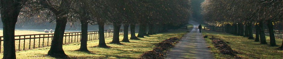
The drive from Waihi Beach to Rotorua took us through more spectacularly beautiful countryside, greener now with steeper hills and deeper meandering valleys. The road’s twists and turns delivering wonderful views over pasture, forest and the occasional vineyard and orchard. The latter usually protected by hedges of towering conifers. The roads are empty by UK standards and a joy to drive. Occasionally our progress is interrupted by roadworks, which reduce the whole road to an unsealed off-road experience; the traffic flow controlled, more often than not, by women wielding lollipop stop/go signs. .
New Zealand skies are as beautiful as the weather is changeable. Where could one see the clearest of rainbows at the same time as a glowing orange sunset? Fluffy white candyfloss clouds float low in the bluest of skies whilst fine wispy strands of clouds high above scurry along at a different pace.
NZ North Island Waihi Beach day 12
The weather is sunny and warm – perfect for a ‘tramping’ through the bush to neighbouring Orokawa Bay. The track runs from the edge of Waihi beach up and round the cliffs. There is a magnificent view looking back along Waihi beach towards Tauranga and beyond . It’s such a clear day that it’s possible to see the whole sweep of the north coast as far as the horizon. Further round the cliff walk we get our first glimpse of the deserted white sands of Orokawa Bay down below. Unfortunately it doesn’t remain deserted for long and by the time we get down on the beach three other people are there too. The pristine picture postcard beach is fringed with gnarled pohutukawa trees – a coastal tree that bears deep red flowers in December – leaning out at right angles over the sand to provide pools of welcome shade. It is just idyllic and we stroll to the far end to enjoy our picnic lunch. The sea is too rough to swim, but we stay a while to sunbathe and watch the dark storm clouds gathering out at sea. We walk on through dense bush – no tourist walkways here – to the William Wright waterfall, a towering sheer rock face with barely trickle of water falling into a small pool below. It is no doubt far more impressive after the rains! The clear waters of the stream we have been following are home to some impressive eels.
We plan to have fish and chips form the local chippie, but when we arrive at 7.15pm it has closed! This is New Zealand. So we hop in the car and drive to Waihi which although deserted, does have a chippie open and Corrie on the TV. The story-line is about six months behind the UK and Andy can’t resist revealing all the upcoming sub-plots to the woman taking our order. She is lapping up, noting down the details, presumably with the intention of impressing friends with uncannily accurate predictions! Good chips, batter is awful!
New Zealand, North Island day 11
We leave Orewa this morning for Waihi Beach on the Bay of Plenty, stopping in Auckland on the way to try to get my Asus screen repaired. We stumbled across a computer repair shop when we were in Auckland last Sunday but it was shut, so we head back there only to find that it will cost about NZ$400 for parts and labour compared to $600 for a new one. So I will continue to use it for the time being, who knows it may last out the trip.
We get to Waihi around 2pm and stop at the local Woolworths – which unlike the chain that until recently existed in the UK, is a supermarket selling mainly food – to get tonight’s meal. Waihi would be a village in England, but is a sizeable town in New Zealand. The town centre is about four streets of single storey shops that look as though they could be facades on a film set. 11km down the road and we arrive at Waihi Beach, a holiday ‘resort’ which, like many NZ suburbs, looks as though it could have been lifted from The Trueman Show or Edward Sissorhands – well-manicured and well-kept but ultimately soulless. It is not a resort in the conventional sense, just holiday homes and and a handful of shops. The beach is 9 km of pristine sand and totally unspoilt – no development whatsoever, just sand dunes.
New Zealand, North Island day 10
The weather’s not so good today, it warm but overcast and there is intermittent rain. We are heading southwards and spend most of the day driving from Whatuwhiwhi to Orewa Beach just north of Auckland. We had planned an early start, but get waylaid talking to a New Zealand woman in her sixties who is on asolo kayaking and walking holiday. She has lived in the US for 38 years and has travelled extensively, so we have lots to talk about. Eventually we get away around midday a bit later than our intended 9.00 am departure. We take the longer scenic route along the Russell Road which involves taking the short ferry ride between Paiha and the Russell peninsular. The detour is definitely worth the extra time for the fabulous views of the rugged coastline and small bays along this stretch of the east coast.
We stop along the way at a small (in NZ terms at least), wild and rocky Elliot Bay which looks the sort that should be deserted. We have to be content to share it with two other people who are here to surf and fish if the boards and fishing rods are any indication, while two more turn up as we are leaving. Why is it that you can never get a beach to yourself when you want one! There is a certain fascination in watching the raw power of the waves breaking far out in the bay and rolling up to crash against this rocky shore and we spend a while strolling along the beach..
This our first night camping. Until now we have stayed in cabins on the Top Ten Holiday Parks. But we are right up against our budget – petrol is costing us more than we anticipated (NZ$1.65 a litre; cheap of course by UK standards) and the decision to take fully comp car insurance blew the hire car budget. So since the hire company gave us a tent for free we’ve decided to save some pennies whilst the weather is good. The holiday parks here offer a range of accommodation from fully self-contained units, kitchen cabins, cabins and campervan and tent sites. But unlike European sites, they are spotlessly clean and provide a comprehensive range of amenities including really good kitchen facilities, laundry and TV room, so camping only means sleeping under canvas, no need to rough it over a two-ring camping gaz stove or sit huddled in the tent when it rains.
The site at Orewa though is probably the poorest we have stayed at. It’s by far the largest but the kitchen is one of the smallest and the fridge and freezer capacity is woefully inadequate; there is barely enough space for our few bits and pieces. Bizarrely the toilet dump is right outside the kitchen door which seems remarkably unhygienic since spilled waste could easily be trodden into the kitchen.
The up side is that the sight is directly on the beach – another huge and windy bay with lots of surf and even a couple of people attempting to ride it. Orewa is a popular holiday and weekend resort for Aucklanders and it is also a one-night stop over for foreign tourists arriving into Auckland airport, picking up a campervan and heading north. We have one such couple pitched next to us who have so obviously never had a campervan before. The little telltale signs – not knowing how far the electrical cable will stretch, not being able to fix the waste discharge pipe so that it doesn’t leak and so on.
New Zealand North Island day 9
The weather is cool and cloudy first thing in the morning, but as we are discovering it is also very changeable and the ever present breeze soon clears the clouds and we have warm and sunny day. This is the last leg in our journey to Cape Reinga, the point in the far north where the Tasman Sea meets the Pacific Ocean. This is a spiritually significant place for the Maori who consider it the jumping off point for souls as they depart on their journey to their spiritual homeland. Along the way there are the most amazing vistas stretching into the endless distance; the green, brown and gold hillsides dotted with trees and bounded by forests. Along the way butterflies flit along the grass verge.
Our first stop is the viewpoint at Cooper’s Beach where, from a small wooden platform, it is possible to survey the immense sweep of Doubtless Bay. We break our journey to book into the holiday park at Whatuwhiwhi on the northern weep of Doubtless Bay. The site overlooks a small sandy beach with rocks at one end covered in rock oysters and harbouring rock pools teaming with life. Sea shells litter the shore inches deep crunching underfoot.
It takes about four hours to drive the 100 or so kilometres from Whatuwhiwhi up the Aupouri Peninsular to Cape Reinga on highway 1; all of it sealed except for the last 15 kilometres. We meet only the occasional car on the way, until we approach the last 10km when several coaches pass us coming in the opposite direction. Apparently, we discover later, the government discourages individuals driving to Cape Reinga and runs an advertising campaign to persuade visitors to join organised coach trips. Fortunately by the time we arrive in the early afternoon all the coach parties have left and we have the place almost to ourselves.
Walking out to the lighthouse promontory the vastness of the ocean stretches as far as the eye can see. To the west the blue Tasman Sea pounds the white sands of Te Werahi Beach; to the east the Pacific is grey and comparatively calm. The waves break at a ninety degree angle to the coast throwing up swathes of pure white surf – is this the point where two oceans collide? Immediately below waves crash over the tip of the Cape below and the white frothy foam merging with the azure blue waters and the brown sand churned by the waves. At the very tip is a spiritually significantly 800 year old pohutukawa tree; souls are believed to slide down its routes.
On the return journey we make a detour to Paua a strip of land jutting out into Parengarena Harbour. There is little here apart from a view of the world’s purest silica sand beach over the water and a gathering of birds which has attracted some English twitchers. We drive on to the perfectly white, silky soft sand beach at Great Exhibition Bay on the Pacific Ocean. This huge expanse of windswept beach is deserted except for two other people. Further south we drive through forest to reach Ninety Mile Beach. This enormous beach stretches almost the whole length of the Aupouri Penins and dissolves into mist in the distance. Four-wheeled drive vehicles can run this hard sand beach at low tide and there are a two cars on the beach when we arrive. It’s windy and the tide is a long way out. We walk to waters edge, where impressive waves are breaking way out from the shore.
New Zealand, North Island day 8
The holiday park at Kerikeri is on the sloping banks of a small river and is the largest of the parks we have stayed at so far. Kerikeri is a small holiday town,population 5000 Kerikeri situated on the far reaches of the Kerikeri inlet which feeds into the Bay of Islands. It is full of hotels and motels and shops catering to holidaymakers. Like all small towns in NZ it is low rise; the housing and shops are predominantly single storey, and the former are usually set in their own plot. There are several historic sites: the Stone Store dating back to 1836 and is the oldest stone building in New Zealand, full of the type of goods that used to bartered in the store, including nail and blankets, all of which can be bought at tourist prices from sales assistants in period costume; and alongside is the pretty white weatherboard Mission House (1822) which is the country’s oldest wooden building. Both face onto the Kerikeri river in a beautifully picturesque setting. The surrounding hills rising up from the river valley are covered in single storey houses all arranged to afford the best possible views of the river below. A short walk from the river across a small bridge is the site of what was once a Maori Pa or fortified village with a panoramic view of the surrounding area. It was from here that the famous Ngapuhi chief Hongi Hika led huge war parties to terrorise most of the North Island and killing thousands in the Musket Wars.
After taking a walk through the forests above the river we take a drive to the Waitangi Treaty grounds further round the bay. This is the birthplace of New Zealand; it was here that the Treaty of Waitangi was signed between the Maori chiefs and the British which established British sovereignty but importantly guaranteed Maoris land rights. The treaty grounds were gifted to the nation by Lord and Lady Bedisloe. On the site are three cultural icons: The Treaty House which is the colonial-style former four-roomed home of the British Resident and later the setting for the signing of the Treaty of Waitangi; the magnificent whare runanga (maori meeting house) which was built by the Maori to mark the centenary of the signing of the treaty and contains wonderful carvings representing the major Maori tribes and traditionally decorated ceiling beams; and the 35m long waka taua war canoe which was also built from for the centenary. There is a remarkable sense of history in this place which seems almost untouched by the passage of time. It could be yesterday that Maori chiefs and the British crown representatives met under a marquee pitched on these expansive lawns stretching down to the shores of the Bay of Islands.
When we arrived in New Zealand we signed up for a member card at the Top Ten Holiday Parks which have a network of sites around New Zealand and for a £14 fee we save 10%. All the sites offer similar a similar range of accommodation from tent pitches to single room cabins, cabins with kitchens and two room units and all provide communal kitchens, shower blocks and laundry facilities. So far they have been clean and well-maintained and represent good value for money compared to other types of accommodation available in ‘In Zid’ as the locals like to call their country.
We are apparently in the grip of a mini heatwave at the moment, the significance of which had passed us by until we saw the headlines in the newspapers today. We had naively thought that temperatures of 32 degrees was quite normal and after SE Asia not particularly noteworthy, but we were wrong. In fact on Wednesday night it was the all time highest low temperature, at 22 degrees, since records began. That may seem a contradictory statement but in fact relates to the lowest temperature day (as opposed to the high of 35.)
New Zealand North Island day 7
Onward and across to the west coast as we make our way steadily towards the far north and Cape Reinga, the point at which the Tasman Sea and Pacific Ocean meet. We are heading for Kerikeri on the Bay of Islands. But first we take a short detour to the Ki Iwi lakes just south of Kuahu between the west coast and Highway 12. We drive is through wonderful undulating countryside to the totally unspoilt lake Taharoa which has a fine, white sandy beach at one end and clear blue waters lapping the shoreline. There is a basic campsite right on the edge of the beach – what a wonderful place this would have been to stay, if only we’d found it earlier.
Back on the road we take the Twin Coast Highway across from west to east stopping at Whangarei to pick up supplies and exchange some books (one exchange bookshop won’t take my Graham Greene or our LP ‘SE Asia on a shoe-string’ – they obviously don’t recognise quality when they see it – but will take Sadie Frost; bizarre!).
We met and English guy from Manchester a couple of days ago who is cycling through NZ while holding down a job in the UK via the internet. He has a fold up mountain bike on which he was managing to carry everything he needed for a camping and working, including a tent which hardly seemed big enough to house him and a laptop. He was relying on mobile telephony to get internet connections – apparently it is possible to buy mobile internet access on a month-by-month basis for about £35. This sounds good value given the sites we are staying at charge up to $9 (£3.25) an hour. So while we are in Whangarei we check out a couple of mobile stores. But the cost of a dongle makes the whole thing far too expensive and the sales assistant can’t confirm whether it could be used outside NZ. So that idea is knocked on the head.
From Whangarei follow Highway 1 through the undulating countryside which is mainly livestock farmland (although there never seems to be many cattle or sheep grazing) pockets of forests on the hillsides and gullies.
New Zealand, North Island day 6
We decide to stay here for a second night to give us time to explore the surrounding area and visit the Waipoua Kauri Forest which is the largest remnant of the once-extensive kauri forests of northern New Zealand. Highway 12 runs through the forest for 18 km and passes some huge trees – a fully-grown kauri can reach 60m in height and have a trunk 5m in diameter. On the way we take a detour off Highway 12 and take an unsurfaced road through Trounson Kauri Park, a beautiful 450 hectare forest dense with native flora including kauri, enormous fern trees and creepers. The kauri forests are also home to the kiwi and the morepork – a native owl. The endangered kiwi is particularly at risk from dogs and there is a widespread campaign here to encourage dog-owners to keep their pets on a lead. We take a short, self-guide walk into the forest to learn a bit more about the different plant species. The forest is dense, humid and impenetrable and wonderfully untouched.
As lunchtime has long since passed by this time and we are feeling increasingly hungry we decide to drive straight through the Waipoua Forest to Omapere at the south head of Hokianga Harbour to get bread and something for tonight’s meal. Finding food in the remote north is proving quite a challenge. We have discovered too late that there are few shops or restaurants on the west coast stretch between Dargaville and Omapere. Our decision is amply rewarded as the descent towards the coast delivers view of the harbour and the coastline north and south of the heads to die for.
Hokianga Harbour – the fourth biggest in the country – stretches out into the distance – a ruggedly beautiful landscape dominated by the magnificent sand dunes across the water at North Head. As the river waters and sea collide turbulent currents create breakers in the mouth of the harbour. About 1 km out to sea huge rollers are breaking on what must be a sandbar or reef whilst breakers pound the shore shoreline. We stop a while to walk along the cliffs of South Head to the mouth of the harbour and sit on the extremity watching the magnificent surf rolling in from different directions and crashing onto the shores all along the coast. Beyond the mouth the harbour in contrast is perfectly calm and the waters are clear and blue.
As we sit eating our lunch in a picnic spot overlooking the harbour the mercurial weather system changes through sun to rain and back again and hot air rising from the harbour condenses adding to the gathering clouds above.
After lunch we return to Waipoua Forest to see the two largest living kauri trees – the mighty Tane Mahuta named for the Maori forest god. At 51m with a 13.8m girth it is the largest Kauri alive and has been standing here for some 1200 to 2000 years. Even though a walkway leads to a clearing in the forest around this ancient it is still difficult to get a picture that captures its incredible size. Further on through the forest is TeMatua Ngahere (the father of the forest). Although smaller than Tane Mahuta at only 30m, it seems much larger with a girth of 16.4m; impressive indeed and we stand contemplating this awesome tree which overshadows all around. Also in this forest is the Four Sisters, a grouping of four kauri which have fused together at the base.
The kauri forest is alive with the noise of cicadas and another insect which we haven’t identified but which makes a clicking sound by clapping its wings together.